You are using an out of date browser. It may not display this or other websites correctly.
You should upgrade or use an alternative browser.
You should upgrade or use an alternative browser.
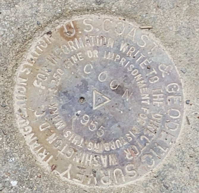
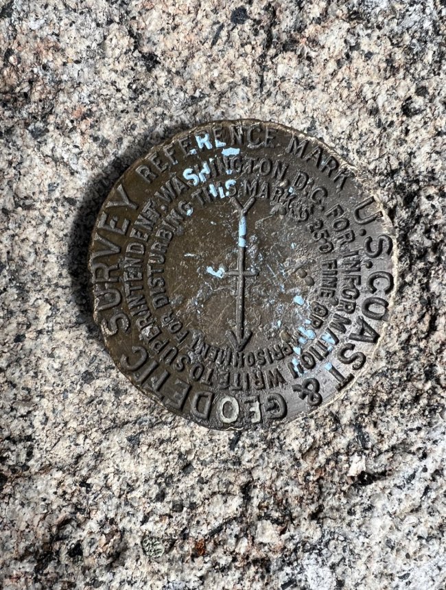
Have you ever found one of these old survey markers
- Thread starter Roro
- Start date
The #1 community for Gun Owners of the Northeast
Member Benefits:
No ad networks! Discuss all aspects of firearm ownership Discuss anti-gun legislation Buy, sell, and trade in the classified section Chat with Local gun shops, ranges, trainers & other businesses Discover free outdoor shooting areas View up to date on firearm-related events Share photos & video with other members ...and so much more!
Member Benefits:
All the time. I supported the National Geodetic Survey for a while as a contractor. .. we also have at least one member who is a federal employee there too.
First one I've ever seen. It is in a WMA In Western md.All the time. I supported the National Geodetic Survey for a while as a contractor. .. we also have at least one member who is a federal employee there too.
I used to see these all the time while working a a rod/chain man on a survey crew over summer months while in college. Locating one if in the immediate survey area was part of the job. They're actually called survey monuments.
US Coast and Geodtic Survey (now National Geodedic Survey) is part of NOAA. Was originally started under Thomas Jefferson. They study how the shape of the earth changes, have continous reference points for GIS and mapping systems, and even do gravity measurements. It is a cool little agency.
Rode by it many times. Finally stopped one day and investigated the concrete circle. Thanks for the info.US Coast and Geodtic Survey (now National Geodedic Survey) is part of NOAA. Was originally started under Thomas Jefferson. They study how the shape of the earth changes, have continous reference points for GIS and mapping systems, and even do gravity measurements. It is a cool little agency.
Afrikeber
Ultimate Member
Yup saw one the other day on the Monacacy Aquaduct.
National Park Service loves to place those all over.
National Park Service loves to place those all over.
I looked into it after I found it. Is there a list of where they were placed?Yup saw one the other day on the Monacacy Aquaduct.
National Park Service loves to place those all over.
Tankfixr
Ultimate Member
There are quite a few on the Furnace Bay/ Stump's Point shore line in the Perryville Community Park.
Just thought it was odd to find one so far from the coastThere are quite a few on the Furnace Bay/ Stump's Point shore line in the Perryville Community Park.
ToBeFree
Ultimate Member
I did land surveying for 20 years. Many in the field. My skill set included reading old monument descriptions for recovery. It was a blast trying to match the old directions to modern topology. Would read like:
From the Post Office in Poolsvile go north along md rt 28 2.3 miles to dim tract road on right. Hence along dim track road 0.73 miles to top of hill. Station located 300' n nw.
ha ha - Good luck.
Once you see them you will see them everywhere!
From the Post Office in Poolsvile go north along md rt 28 2.3 miles to dim tract road on right. Hence along dim track road 0.73 miles to top of hill. Station located 300' n nw.
ha ha - Good luck.
Once you see them you will see them everywhere!
Once you see them, You'll see they're pretty much everywhere.Just thought it was odd to find one so far from the coast
National Geodetic Survey Data Explorer
LOL - just saw TBF's post above this one.
Here's one from atop the Enchanted Rock monolith, just outside of Fredericksburg, TX that I took on vacation a few years ago.
Last edited:
crolfe1984
Enthusiast
Reminds me of those USGS survey markers you see at the top of mountains. I remember summiting Mt. Whitney in 2016 and looking for the marker!
- Jul 29, 2014
- 50,073
I had a buddy in high school who spent a summer on a crew installing those. The ones they were doing were embedded in a small pillar of concrete and were supposedly used to monitor land erosion.
Diesel-Dad
Active Member
I’ve seen a few of these at a scout camp in my youth. Never knew what they were.
Sent from my iPhone using Tapatalk
Sent from my iPhone using Tapatalk
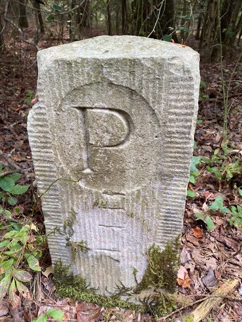
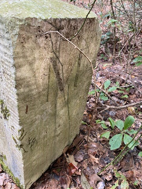
Heres one in Sussex DE with a P on one side and M on the Maryland side.
Some very similar to the others pictured are over on Line Rd but indicate Mason Dixon and are located in vaults straddling the roadway.
You have to lift a cover to see them.
Some very similar to the others pictured are over on Line Rd but indicate Mason Dixon and are located in vaults straddling the roadway.
You have to lift a cover to see them.
Attachments
Yup - there is one at Dan's Rock (good spot with friends from my days at the real FSU - not that wanna-be in Florida).Anyone ever found one of these
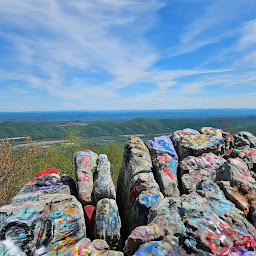
Dans Rock Overlook · 17600 Old Dans Rock Rd SW, Rawlings, MD 21557
★★★★★ · Scenic spot
Get a topo/quadrangle map for your area and go out and look for them.
I'll have to do that. ThanksGet a topo/quadrangle map for your area and go out and look for them.
h2u
Village Idiot
Users who are viewing this thread
Total: 2 (members: 0, guests: 2)

Forum statistics
Latest threads
-

-
-

-
 Grand Power Stribog Restocked 9mm & 10mm $689.95 to $1649.00 Shipped (1 Viewer)
- Started by DK Firearms
- Replies: 0
-
-

-
