- Jan 17, 2011
- 1,837
I'm trying to make up a map showing, county-by-county, where law-abiding citizens can get carry permits. I've already got a lot done, and it's something I think would surprise a lot of Marylanders:
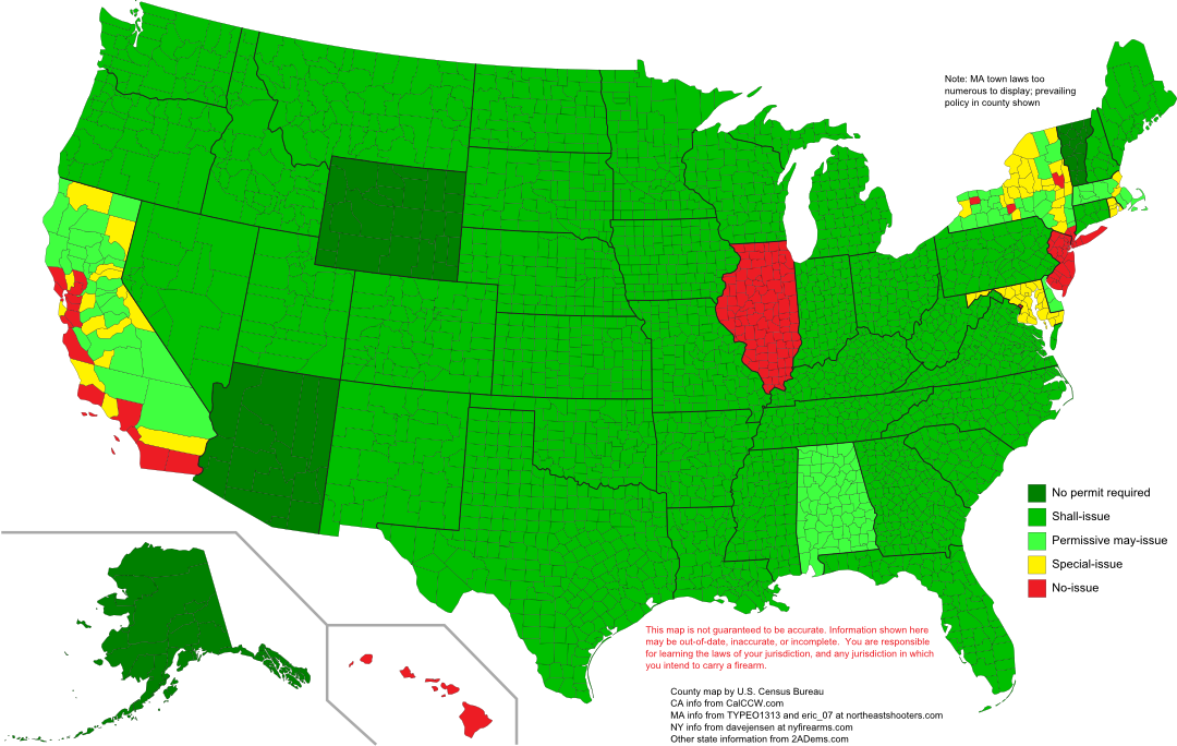
I've got a large vector map at http://www.mediafire.com/?g18eco0i8r4g979 and a bigger PNG at http://i.imgur.com/nYy2m.png.
And just for the hell of it, I made a cartogram, too! It's not as encouraging, but it's important to know what the human geography looks like, too. Area on this map translates into people. That is, the size of each county on the map is proportional to its population.

Vector map at http://www.mediafire.com/?b51ap78ehpafbgg, and a bigger PNG at http://i.imgur.com/AOz3T.png
NOTE: Everything updated 1/28/12
Suggestions? Corrections? Advice?
Thanks to shawn for more Massachusetts info
Thanks to Doug33w for more New York info
I've got a large vector map at http://www.mediafire.com/?g18eco0i8r4g979 and a bigger PNG at http://i.imgur.com/nYy2m.png.
And just for the hell of it, I made a cartogram, too! It's not as encouraging, but it's important to know what the human geography looks like, too. Area on this map translates into people. That is, the size of each county on the map is proportional to its population.
Vector map at http://www.mediafire.com/?b51ap78ehpafbgg, and a bigger PNG at http://i.imgur.com/AOz3T.png
NOTE: Everything updated 1/28/12
Suggestions? Corrections? Advice?
Thanks to shawn for more Massachusetts info
Thanks to Doug33w for more New York info
Last edited by a moderator: