Much like the US map, MD is mostly Republican territory. As the saying goes, it's a shame a few have to ruin it for all."
http://senatorstevewaugh.com
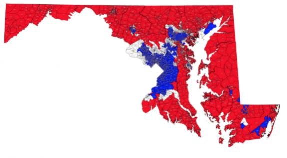
The map (red = top tier republican winner in 2014 and 2016, blue = dem top tier winner in 2014 and 2016, white = flipped one way or the other between the 2 election years):
http://senatorstevewaugh.com
The map (red = top tier republican winner in 2014 and 2016, blue = dem top tier winner in 2014 and 2016, white = flipped one way or the other between the 2 election years):