Garmin GPS , Maps, Analysis Paralysis

The #1 community for Gun Owners of the Northeast

Member Benefits:

  • No ad networks!
  • Discuss all aspects of firearm ownership
  • Discuss anti-gun legislation
  • Buy, sell, and trade in the classified section
  • Chat with Local gun shops, ranges, trainers & other businesses
  • Discover free outdoor shooting areas
  • View up to date on firearm-related events
  • Share photos & video with other members
  • ...and so much more!
  • Biggfoot44

    Ultimate Member
    Aug 2, 2009
    33,137
    * Entire discussion is in the context of handheld units , and usage actually in the woods for hiking, hunting, 4x4ing, occasional geochaching . NOT normal automotive use, or navigating on normal roads . *

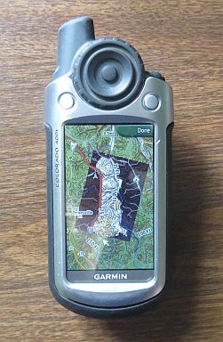
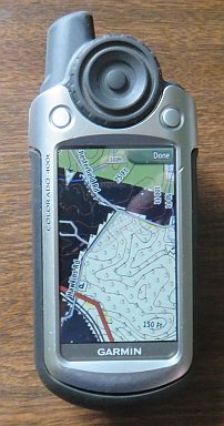
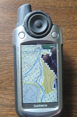
    The likely unit will be Garmin eTrex 20x for multiple reasons . Slippery slopping to higher price tier not on the table .

    ***************

    One of the online vendors is offering a bundle with Garmin 24k map card for one region . I was psyched until discovering that the border between their Northeast Region and Southeast Region bisects the areas of intrest to me .

    I called Garmin cust support , and paraphrased to my Luddite- like level , I could download both , and burn them into a microSD and use both regions , but with factory preloaded cards, I would have to swap cards at the border .

    Meanwhile , the nice gentleman pointed out that their 100k ( 1:100,000) series covers the whole country, albeit with less details.

    Then I looked further through the Garmin website, and became really confused.

    Their is a product called " Raster " maps . They are a representation of old school paper topo maps, lack ability to move features, add names, etc . But I'm an Old School guy, cut my teeth on paper topo maps, and think in paper topo maps .

    This product is listed as an annual subscription, with further comment that whatever is IN the GPS will continue to work after the subscription term .

    Soooo, what's up with this ? USGS updates operate on the order of decades , so there is little concern of being outdated . When I get a 1yr " subscription " do I instantly get the whole country's USGS maps downloaded ? Could I somehow use them on a big computer screen ? Or do I only get access to areas I physically vist during the subscription term ?

    Or should I just say the heck with this new fangled crap, and do as I did 10-ish yrs ago . Carry a real topo or WV DOT County map, use GPS to read actual Lat Long , and then use the real map ?

    ( I am old school enough I am comfortable navigating from known point to desired point with map & (real) compass . The GPS gives the luxury of getting twisted around , or if various trails are ambigous on the ground , to find out " where the Heck am I ? " .
     

    Antarctica

    YEEEEEHAWWW!!!!
    MDS Supporter
    Sep 29, 2012
    1,733
    Southern Anne Arundel
    Or should I just say the heck with this new fangled crap, and do as I did 10-ish yrs ago . Carry a real topo or WV DOT County map, use GPS to read actual Lat Long , and then use the real map ?

    Warning: Opinion forthcoming...

    ^^^On land, this. For all the frustrations you listed above. I'm old school, and I like paper when I'm walking around. And I hate being tied to some stupid 'subscription'.

    If I'm at home, doing some research on an area, sure, give me google maps and topos. But by the time I'm out on the ground, I should have a pretty good sense of the lay of the land and then paper is enough, with a lat long very rarely needed.

    Even in the car, I prefer an old gazeteer over a moronic GPS/mapping program.

    On the water, I'm all for electronic maps/charts, But I've got a boat and power, and I'm covering more ground (ok,.. water) more quickly, and there are some fantastic free tools and charts out there that can run off a PC/Mac. Those charts also give all the nav data - buoys, beacons, etc.. I still like to have paper on board though, even if its low resolution.

    That said, I'm sure someone will chime in here with better solution on land, so I'm hoping I learn someones tricks...

    Brent
     

    Biggfoot44

    Ultimate Member
    Aug 2, 2009
    33,137
    I generally have good sense of direction , and geographic awareness . The one time a friend was trying to be helpful riding with me providing GPS aided directions , it drove me batty, and a 10sec glance at paper map showing location of our destination would have handled it all .

    But that said , twice ( when not having a GPS ) I was stumped on forstery roads/ jeep trails in WV . The available mapping and reality on the ground frequently don't match up . The "real" road can be so overgrown I don't realize it even when I'm there. Actual cow paths can initially be quite proment appearing at the start, then disappear, when the trail I thought it was is known to continue.

    Or I knew the real forrestry road I started on, but interescting roads happened where there shouldn't have been any , none were marked or signed, and the seeming most travelled ones keep disappearing or dead ending .

    I intellectually knew which directions I needed to head , but after a half dozen series of contour hugging switchbacks , could only have a general sense of compass points, but not enough to fully commit to a specific faint two track . And the family was giving me looks after an hour of dead ends , and had to back track an hour to starting point. Lost some Mighty Woodsman cred points that day .

    ******************

    While only partial nexus to navigating, I do enjoy the screen for distance travelled, current speed , cumulative average moving speed, and cumulative overall average speed.
     

    outrider58

    Eats Bacon Raw
    MDS Supporter
    Jul 29, 2014
    49,982
    Warning: Opinion forthcoming...

    ^^^On land, this. For all the frustrations you listed above. I'm old school, and I like paper when I'm walking around. And I hate being tied to some stupid 'subscription'.

    If I'm at home, doing some research on an area, sure, give me google maps and topos. But by the time I'm out on the ground, I should have a pretty good sense of the lay of the land and then paper is enough, with a lat long very rarely needed.

    Even in the car, I prefer an old gazeteer over a moronic GPS/mapping program.

    On the water, I'm all for electronic maps/charts, But I've got a boat and power, and I'm covering more ground (ok,.. water) more quickly, and there are some fantastic free tools and charts out there that can run off a PC/Mac. Those charts also give all the nav data - buoys, beacons, etc.. I still like to have paper on board though, even if its low resolution.

    That said, I'm sure someone will chime in here with better solution on land, so I'm hoping I learn someones tricks...

    Brent

    ^^^This^^^

    Besides, if you get really lost, maps make good fire starter. ;)
     

    lx1x

    Peanut Gallery
    Apr 19, 2009
    26,992
    Maryland
    ^^^This^^^

    Besides, if you get really lost, maps make good fire starter. ;)
    Or tp.


    Op:. If you have smartphone.. why not use that. There are few free gps app you can download. Unless you go hardcore hiking/offroading (days)..

    Handheld gps downfall is their outdated maps and expense to upgrade it.
     

    BigSteve57

    Ultimate Member
    Feb 14, 2011
    3,245
    I love GPS units for the outdoors. I also carry a topo in case the darn thing breaks or I stupidly forget to bring enough batteries. None of those things has happened, yet. EDIT: I also carry a MIL spec tritium compass!

    One of the things I really love about GPS units is the ability of some units to "geolocate" a map image or other type of image into the GPS. This allows you to look at your location, set waypoints etc… and see yourself on YOUR map with your GPS unit. For example, I hunt the Crownsville Wildlife Management area and I geolocated MD DNR's map of the area into my Garmin so that as I walk the hunting area I can see where I am on their map. I can see prohibited areas, safety zones and other critical information like where the parking area is!

    You can do this with any map, topo or otherwise. All you need is an image. You could, for example, do it with a map of Disney World. The map does have to meet some basic criteria like being geographically proportional but any topo map or anything lifted from Google Maps, Bing maps, or Google Earth will fit that criteria.

    Best of all, your map can be to any level of detail and is usually FREE!


    BTW, I intend to do this with detailed maps prior to our hunting trip to Montana's Beaverhead National Forest this November.

    REF:
    Crownsville map that I scanned:
    http://dnr.maryland.gov/wildlife/Documents/Crownsville_CWMA.pdf


    Images of my Garmin GPS with above DNR image geolocated into it:
     

    Attachments

    • IMG_2980cs.jpg
      IMG_2980cs.jpg
      27 KB · Views: 221
    • IMG_2981cs.jpg
      IMG_2981cs.jpg
      19.9 KB · Views: 218
    • IMG_2982cs.jpg
      IMG_2982cs.jpg
      26 KB · Views: 225
    Last edited:

    Devonian

    Ultimate Member
    Apr 15, 2008
    1,199
    I sold my gps unit and only use my cell phone. There are great apps like Gaia and onx maps that have both aerial imagery and usgs quads for the entire country. If you are going into an area with no cell service you can save the maps and imagery in your AOO and you can operate off of your phones gps capability which is not dependent on cell service.
    Anyway just an other option to think about.
     

    Antarctica

    YEEEEEHAWWW!!!!
    MDS Supporter
    Sep 29, 2012
    1,733
    Southern Anne Arundel
    BigSteve57's point is exactly the kind of thing I thoguth I might learn about in this thread. Very cool. I've known about geolocating maps in PC based systems (in fact, the older open source 'charting' software relied exlusively on that capability when freely available electronic charts were non-existent).

    Good stuff.

    ...but I still like paper!
     

    BigSteve57

    Ultimate Member
    Feb 14, 2011
    3,245
    A GPS is a crutch for sure but I won't enter the woods without one. For a time being we did orienteering for fun and to learn survival skills. This is how we became familiar with maps & compass. But we were in no real danger.

    A fun thing we've done with our GPS is test our survival skills and sense of direction. We've done this in forests and from major trails like the Appalachian trail.

    On a cloudy day with no sun to reinforce your sense of direction, step 50-100 yards off a trail. Do this at dusk when shadows appear and everything starts to look different and darkness comes on you like a blanket. You may notice as we did that you can become disoriented FAST as everything looks alike in all directions. This is when people, myself included, start to panic. So once you're off-trail and out in the deep woods, test your sense of direction - decide which direction is the way out using your common sense, then your topo, then your topo & compass. Finally, use your GPS to confirm.

    You may find, as we did, that your innate sense of direction is often dead wrong.

    I imagine survival courses can teach better skills but we haven't done that as the GPS is such an amazing tool (crutch).
     

    Biggfoot44

    Ultimate Member
    Aug 2, 2009
    33,137
    I started this thread because I am just scratching the surface of realizing what I don't know. But BigSteve57's post #6 has lots to follow up upon .


    Indeed , the(as pictured ? ) ability to look at the screen and see the representation of the proverbial " Where the hell am I ? " , and related " where the hell is that boundry ? " are part of what was in my mind , but not able to describe .

    So 'splain this Geolocating , Steve or whomever . Doesn't this require , you know , Maps loaded into unit ?


    Meanwhile, zooming in on Pics , Steve has a Colorado 400t . They're discontinued , but checking in Garmin archives, they came from the factory pre-loaded with Topo maps .

    The Colorado product line us history , but it seems the current counterparts are the Oregon product line . Different results which one would be counterparts of Steve's , with both Oregon 650t @ $300-ish street, and Oregon 750t @ $550-ish street coming up .


    Are these cool abilities somthing that require a $$ unit to do ?

    My options are eTrex 10x and eTrex 20x . Even if I could beg my way into an Oregon , I'd have to trade away 2018 birthday and 2018 Christmas gifts , and I don't plan to go there .

    In that context , does the 20 offer anything ( other than color screen ) over the 10 without spending the cost of case of ammo to get maps ?
     

    BigSteve57

    Ultimate Member
    Feb 14, 2011
    3,245
    I'm not up on the latest GPS units and which ones they can host images. But I would insist on one that could.

    Attached are the instructions for adding images to Garmin units taken from various blog sites. Below is how I started with the MD DNR map - I later edited the image to remove all the legend information. Again, this could be literally any image or map, that once geo referenced can function in your GPS. I think this is way harder than it ought to be and maybe newer units make this easier.

    BTW, you're getting the benefit of hours of searching ! :D
     

    Attachments

    • Crownsville_CWMA-GoogleEarth-s - Copy.jpg
      Crownsville_CWMA-GoogleEarth-s - Copy.jpg
      39.4 KB · Views: 123
    • Creating Photos & Image Overlays in Google Earth.pdf
      1 MB · Views: 80
    • GarminCustomMaps.pdf
      665.3 KB · Views: 75
    • GarminCustomMapsInstructions.pdf
      1.4 MB · Views: 82

    Biggfoot44

    Ultimate Member
    Aug 2, 2009
    33,137
    THANKS Steve .

    So I presume there is an advantage to the one capable of loading maps ( the 20 ).

    I'll have Biggfootette do the computer stuff when the time comes .
     

    BigSteve57

    Ultimate Member
    Feb 14, 2011
    3,245
    THANKS Steve .

    So I presume there is an advantage to the one capable of loading maps ( the 20 ).

    I'll have Biggfootette do the computer stuff when the time comes .

    Be careful - I went to Garmin's website and saw that the unit advertises it can add maps. It appears to me (I could have this wrong) that this is adding maps via purchased sd cards or via maps that you have to purchase. It is not the same thing that I did and not nearly as powerful a feature in my opinion.


    If adding custom map images/overlays is a feature you want you might want to contact Garmin about the unit's capability.
     

    Biggfoot44

    Ultimate Member
    Aug 2, 2009
    33,137
    So back to no map capability then.

    My potential gift budget only extends to a 20 , doubling or trippling the $ not an option .

    When I actually spoke to live human with apparent 'murican accent at the actual Garmin , he was speaking about loading/ combining "stuff" onto micro SD using computer, and inserting card into unit .
     

    BigSteve57

    Ultimate Member
    Feb 14, 2011
    3,245
    So back to no map capability then.

    My potential gift budget only extends to a 20 , doubling or trippling the $ not an option .

    When I actually spoke to live human with apparent 'murican accent at the actual Garmin , he was speaking about loading/ combining "stuff" onto micro SD using computer, and inserting card into unit .

    Hmmm. Maybe the process to add custom map(s) like I did is available but is done in a different way. The Colorado connects to the computer via USB and also has a SD card slot. The spot on the Colorado where the custom map goes is shown as a folder on my PC when I connect it via USB.

    Colorado has a built in Topo map, a streets map that is in a SD card and my custom-scanned map(s) that I scanned geo-referenced on Google Earth. Each of the 3 maps appears as an item in a checkable list in the unit's list of available maps. In the case I illustrated I selected "US Topo" and my scanned image when hunting. For the trip to the deer processor I select the streets map and un-select my scanned image.
    The unit could host multiple custom scanned images if I chose to enter them. The other higher end Garmin units like Oregon, Montana etc... also work this way.

    This feature is really cool (if you're a geek like me :D).
     

    Biggfoot44

    Ultimate Member
    Aug 2, 2009
    33,137
    Just clicked to create a POI account, hopefully can get to email today to retrieve the password.

    In this context, what is " POI' ?
     

    bmorewineguy

    Active Member
    Sep 29, 2013
    216
    Edgewater
    I just got back from a trip off roading in the George Washington National Forest and I used the forest service maps and Delorme paper maps along with my phone. I don't have a gps unit except for the ability of my phone which was very spotty in the mountains. Not sure where you're going or doing but you might find the below website helpful.

    here is link to the forest service maps. The Motor Vehicle Use Maps shows what roads are seasonally closed which was good for planning the trip. I printed the forest service map out and put it in a 3 ring binder, it was very helpful.

    https://www.fs.usda.gov/main/gwj/maps-pubs

    This might help also
    https://www.fs.fed.us/recreation/programs/ohv/ohv_maps.shtml
     

    Users who are viewing this thread

    Latest posts

    Forum statistics

    Threads
    275,372
    Messages
    7,279,171
    Members
    33,442
    Latest member
    PotomacRiver

    Latest threads

    Top Bottom